Most people have heard how hurricane Katrina ravaged the city of New Orleans and devastated the gulf coast of Mississippi. Mike Collins of Destin, FL is one of the many people helping in the clean-up effort. “I couldn’t believe my eyes when I first arrived in Gulfport and saw the damage”, Mike reported. “The tallest thing you could see along the beachfront were the cement slabs where homes once stood. I saw trailers that were washed 4 miles inland. People were living in tents. The bridge to Port St. Louis looked like an atom bomb had hit it. There wasn’t a single piling along its three and a half mile span that wasn’t damaged.”
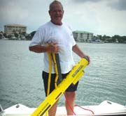
Mike has been very busy using his JW Fisher side scan sonar to survey harbors and waterways around the city of Gulfport, MS. When he began surveying it seemed there was no end to the amount of debris littering the bottom. There were boats of all sizes and shapes, cars, trucks, pieces of trailer homes, and tons of other junk. In the old days when storms hit and carried debris into the waterways, salvagers would go out in boats and drag hooks around. When the hook grabbed onto something, it would be pulled from the water. But in aftermath of Katrina, there was so much junk strewn throughout the waterways it would be far too time consuming to do it the old way. A new and better technology was needed to find the debris and mark it’s location for removal. This was one of the primary reasons officials made the decision to bring in Mike and his side scan sonar.
"To tow the side scan I brought over a trailerable catamaran. It’s perfect for the shallow water of the harbor and inland waterways. I set the side scan on the 600K frequency and lowered the fish just a few feet beneath the surface. This worked perfect and gave me great images of the bottom. You could easily see how each target was laying. The objective of the clean-up was to remove anything that was larger than a 5 gallon bucket. I would take the engineers out on my boat and drop a 5 gallon pail over the side with a buoy to the surface. The engineer could see the bucket on the sonar and then quickly determine if other objects were larger or smaller. I ran grids so the navigation pilings along the edge of the channel were visible in the sonar image. This made it easy to determine exactly where the target was laying."
In a matter of a few weeks Mike completed 5 major survey jobs including the submerged structure of the Highway 90 bridge, Bay St. Louis Yacht Harbor, Pass Christian Harbor, Long Beach Harbor, and the Grand Casino Harbor. Officials were so pleased with the results they asked him to come back after the clean-up and resurvey the area to make sure the job is complete.”